How does a topographic map help an architect? This comprehensive guide delves into the multifaceted role of topographic maps in the architectural process, providing a detailed understanding of their benefits, limitations, and practical applications. Architects rely heavily on these maps to make informed decisions that shape the design and functionality of buildings.
Topographic maps provide architects with a precise representation of the natural and man-made features of a building site. They depict elevation, slope, and other crucial terrain characteristics, enabling architects to plan and design structures that seamlessly integrate with the surrounding environment.
Understanding Topographic Maps

Topographic maps are graphical representations of the Earth’s surface, providing detailed information about the terrain and natural features. They are essential tools for architects, engineers, and other professionals involved in land planning and development.
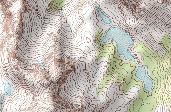
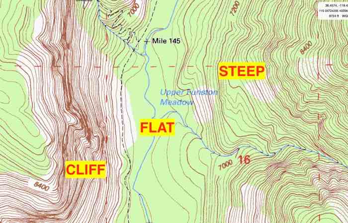
Key elements of topographic maps include contour lines, which connect points of equal elevation, and elevation markers, which indicate the height of specific points above sea level. Symbols are also used to represent various features, such as buildings, roads, and water bodies.
Types of Topographic Maps
- Planimetric maps: Show only the horizontal features of the terrain, such as roads, buildings, and water bodies.
- Contour maps: Use contour lines to represent the topography of the land.
- Orthophoto maps: Combine aerial photographs with topographic data to provide a realistic view of the terrain.
- Digital elevation models (DEMs): Store elevation data in a digital format, allowing for precise analysis and visualization.
Role of Topographic Maps in Architecture

Topographic maps play a crucial role in architectural planning and design by providing information about the site’s topography, slope, and drainage patterns.
Site Selection and Analysis
- Identify potential building sites with suitable slopes and elevations.
- Assess the potential for flooding and erosion.
- Determine the best orientation for buildings to optimize natural light and views.
Building Orientation and Design
- Influence the shape and size of buildings to fit the terrain.
- Minimize the impact of slopes on building design.
- Maximize views and natural ventilation by considering the topography.
Benefits of Using Topographic Maps

Topographic maps offer numerous benefits for architects, including:
Time and Resource Savings, How does a topographic map help an architect
- Reduce the need for extensive site surveys, saving time and resources.
- Facilitate accurate site planning and design, minimizing costly mistakes.
Site Planning and Drainage Design
- Identify optimal locations for roads, parking lots, and other infrastructure.
- Design drainage systems that effectively manage stormwater runoff.
Risk Mitigation and Safety
- Identify areas prone to flooding, landslides, or other hazards.
- Ensure the stability and safety of structures by considering the topography.
Limitations of Topographic Maps

While topographic maps are valuable tools, they have certain limitations:
Accuracy and Resolution
- Contour lines may not accurately represent the actual terrain, especially in areas with steep slopes or dense vegetation.
- The resolution of topographic maps can vary, affecting the level of detail available.
Other Factors
- Topographic maps do not provide information about soil conditions, vegetation, or other environmental factors that may impact building design.
- Changes in the terrain over time may not be reflected on topographic maps.
General Inquiries: How Does A Topographic Map Help An Architect
What are the key elements of topographic maps?
Topographic maps include contour lines, elevation markers, symbols, and other features that convey information about terrain elevation, slope, and other physical characteristics.
How do topographic maps assist architects in site selection?
Topographic maps provide insights into site conditions, allowing architects to identify optimal locations for buildings based on factors such as drainage, slope stability, and accessibility.
What are the limitations of topographic maps?
Topographic maps may not capture all subsurface conditions or environmental factors, so it’s crucial to consider additional data sources when making design decisions.